
The Rogue River Watershed Partners and SWMTU have RESCHEDULED our 2026 Annual Rogue River Cleanup to take place on Saturday, June 13, from 10 a.m. - noon!
Rogue River
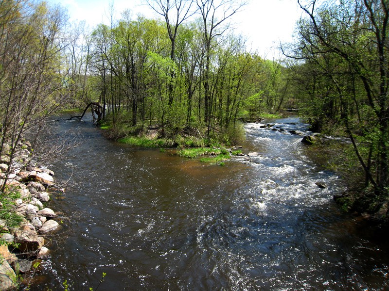
The Rogue River is a major tributary of the Grand River and flows generally north to south through Rockford, Michigan. The watershed is 234 square miles and covers counties, though most of it is in northwest Kent County.
Much of the river is warm water, especially in its upper reaches. As it approaches the Grand River, smaller tributaries and ground water springs turn the river colder and it can support good populations of trout. Additionally, the river gets seasonal runs of steelhead, Chinook salmon, and Coho salmon all the way up to the dam in Rockford.
Important tributaries for cold water include Spring, Cedar, Duke, Stegman, Rum, Shaw, and Barkely Creeks.
The river has long been a focus of efforts from SWMTU and other area environmental groups. Current efforts include work done by the Rogue River Home Rivers Initiative and the Kent County Brook Trout Study.
2021 Temperature Monitoring Study
Trout Unlimited national did a comprehensive temperature monitoring effort in 2021 on the Rogue River watershed. You can find a map displaying the results of the 2021 Temperature Monitoring Survey here.
The data is displayed based on Maximum Weekly Average Temp (MWAT). This statistic is often used by researchers to understand thermal habitat suitability for trout and other coldwater species. It is the highest average temperature for any 7-day period during the monitoring effort. Generally, for trout, an MWAT below 66 is fantastic, 66-70 is good, 70-73.4 is marginal, and greater than 73.4 are not good temperatures for trout. Areas that have higher temperatures may still support trout populations but usually at much lower abundances. If you click on the site marker, a box will pop up that will also show the July average, which is the metric Michigan DNR uses to evaluate stream temperature.
A few observations from the data.
- Much of the Rogue River between Alpine Avenue and the mouth of the river was in the marginal (yellow) or the lower end of the warm (red) categories.
- Most of the high-quality coldwater streams (blue) in the watershed are right around Rockford.
- TU lost both loggers on Duke Creek, a tributary further up in the headwaters that would likely have fallen in the green or blue category. Though TU did characterize some cold tributaries to Duke Creek.
These data are being shared with various partners including DNR, the Rogue River Watershed Partners, the Land Conservancy of West Michigan, the Lower Grand River Organization of Watersheds, and Kent Conservation District to aid in the prioritization of restoration and protection efforts in the watershed.
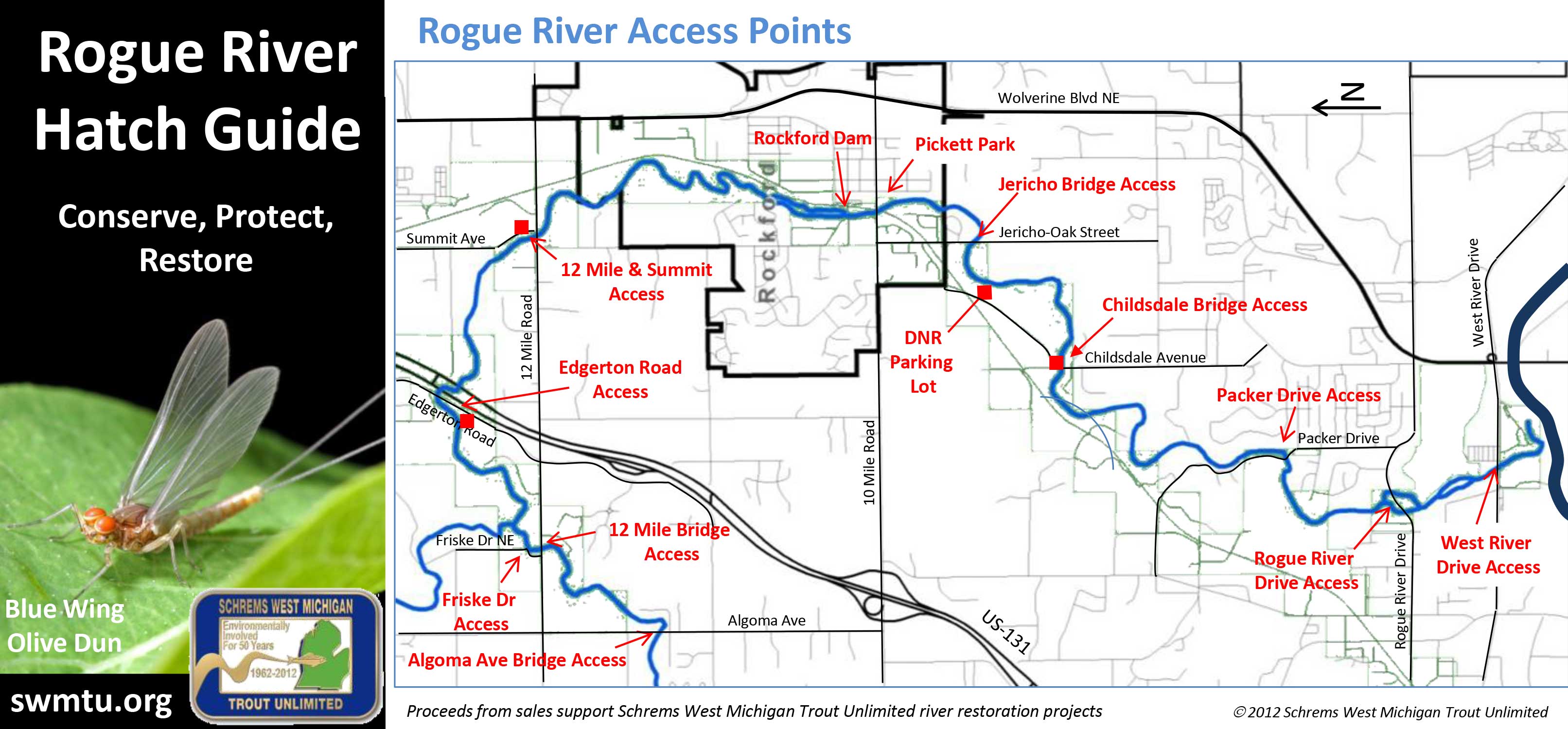
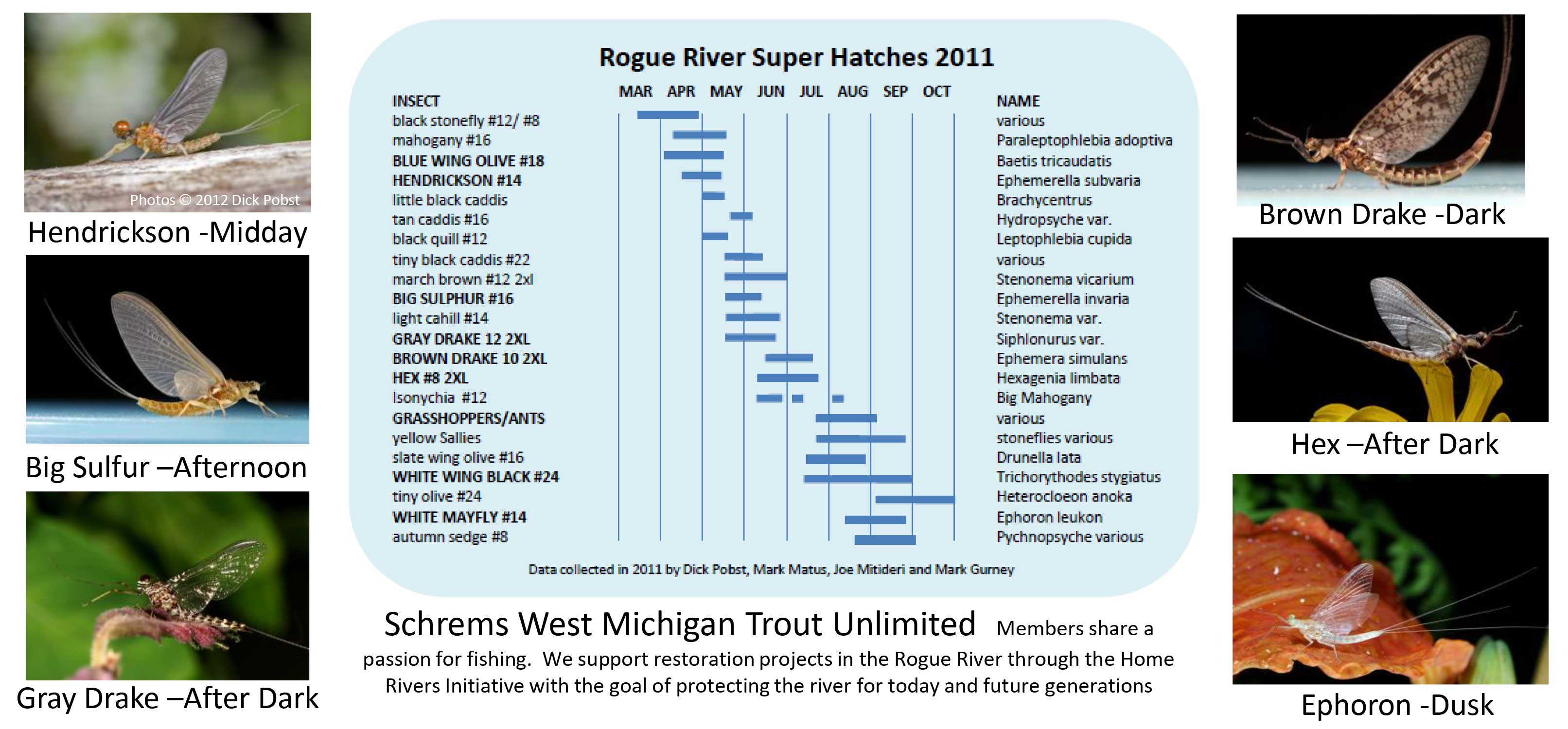
Rogue River Hatch Guide & Public Access
The following images represent two sides of a printable Rogue River Hatch Guide. It shows some of the common hatches that occur and access points along the river. Click on each image to view a larger version.
Reports from the Rogue River

Fly Fishing Outings with SWMTU
Enjoy our local watersheds and make new fishing buddies by joining SWMTU for fishy evenings in May, August, and October.

2025 Rogue River Cleanup
Join us on May 10 for a day of giving back to our community and watershed by preventing plastic pollution and other contaminants from entering the river.

2024 Rogue River Clean up
Volunteers will gather at Richardson-Sowerby Park and then be assigned sections for cleanup along with the distribution of trash bags.

Rogue River Cleanup
October 7 -- Sponsored by Trout Unlimited, LGROW, and Rogue River Watershed Partners.

Trees planted along Gougeburg Landing
This new park along the Rogue River features great access to the river.